This Landscape is your Garden

Jimmie F. Jones, Point Sublime, 2009. Oil on canvas, 54 x 120 in. Southern Utah Museum of Art
A digital geospatial map is constructed by adding layers and layers of points on top of one another, they are coordinates that place a pin into a grid, something that says this event happened here. Southern Utah is a space that people have been mapping for thousands of years and layer on top of layer these narratives have been imprinted on to this landscape. These narratives are documented in newspapers, paintings, family and oral histories, marketing flyers, city plans/designs, and even the landscape itself. Armed with Johanna Drucker’s The Digital Humanities Coursebook and employing the use of digital tools I set out on a mission to answer the question “What stories are told about Southern Utah?” In my exploration I discovered that more accurately I am answering the question: "What are the stories do we tell about Southern Utah?" The we is important as I have lived here, in Ivins, Utah, for ten years learning and growing in this space, telling my own stories of the canyons, the wind, the heat, and the complex social environment that are all a part of this landscape. Through exploring this page you will have the opportunity to follow me on my journey as I try to derive meaning from the myriad of myths and stories that are stitched into the social fabric of this area like a patchwork quilt.
Using digital tools to find meaning
This project is anchored to my discovery process where I used digital tools such as distant reading and Voyant Tools. This required me to mine data from historical resources and texts that were in the public domain that already existed in a digital format through scanned pages in the University of Utah library collection. This process of looking through “free” information in the public domain to discover what stories the first European settlers of Southern Utah told about themselves and the land through the local section of the first newspaper highlights the immense possibilities of digital humanities projects. These digital tools helped me find patterns that I would have missed during my close reading of the text and these insights have helped me derive personal meaning from these historical resources. My results inspired me to apply this method to more contemporary documents such as the Ivins City General Plan and my own written work as I analyzed a personal essay about Snow Canyon State Park to see if there are any patterns or commonalities between the narratives told in these documents.
St. George Union, 1878
Before I began the process of mining my data, I took inspiration from this quote by Johanna Drucker: “You begin with a question and/or a collection (files, images, texts, maps, data, field notes, photographs, or any trace of remains) and then work with digital methods to create a research outcome.” (11) I began with the question: “What stories do we tell about Southern Utah?” I was curious to see how the founders/developers of Southern Utah answered this question. I found a collection of newspapers and set some parameters in order to collect data. I selected the first year of the St. George Union, as there are only ten issues (collectively about 10,000 words), which I feel is enough material to collect data that will sufficiently answer the research question. I also recognized that this process will first involve gathering quantitative data, looking at the specific number of times certain words, or topics, are repeated in the text. Second, a qualitative analysis of the text through close reading will help provide context for the use of terms and help me answer the research question and create a concept for my rhetorical map (see map at the bottom of the webpage).
I began by copying and pasting the text from the “Local” section into a Word document, which produced dirty text. After I cleaned up the data, which required doing a close reading and changing the dirty text by hand, I pasted it into Voyant Tools, eliminating dates so that only the content of the local section was analyzed. The findings produced some interesting results, but I did recognize some issues such as redundant and repeated topics. A close reading of the text helped me cipher through the topic model and eliminate some redundant terms which did not support any research outcomes. For example, I noticed that St. George is the most repeated term in the topic model, but on a close reading of the text, the term St. George is only used to establish place, and does not really say anything about what the writers were trying to convey in this section of the newspaper. I chose to select the terms "Abundant", "Water", "Weather", and "Crops" for my visualization because they help tell the story of the local section in the newspaper and illuminate the intentions of the writers for this section of the newspaper.
Figure 1
Ivins City General Plan
The current level of commercial development in Ivins, Utah stands in stark contrast with my findings from this historical source. I wanted to try this similar inductive approach with the Ivins City General Plan to see if any patterns or commonalities existed between the texts. I was curious to discover what would be the most dominant terms used in the plan, which was compiled in 2015, but still serves as the current plan for the city. This approach with Voyant Tools allows you to be both the ethnographer and the anthropologist as the digital tools provide an unbiased analysis of the materials and my findings. They also helped me recognize links between generations of people who have lived in the same place, patterns of behavior that determine cultural practices and beliefs. The Ivins City General Plans has significantly more content to draw from as the plan is a public document that is 42 pages in length and a total of 13,194 words.
By only looking at the results of the distant reading the terms are not unsurprising for a city plan, but the only similarity between the St. George Union and the Ivins City General Plan is the word "water" (Figure 2). Water is clearly a concern for both the settlers and the residents of Ivins city. However, based on the results of a close reading of both texts, water is a concern for the early Utah settlers due their concerns with agriculture, while water for the city of Ivins is a concern for the plan's intentions to turn Ivins into a vacation destination which is goal number six of the city's general plan.


Place your cursor over the image to see pages from the St. George Union newspaper from 1878
The newspaper in 1878 served as a religious tool for the community. The front page consists of a church hymn, a poem with a church theme, and portions of a sermon given by Joseph Smith, the founding prophet of the Mormon church, at the funeral of a beloved patriarch. Specifically, the local section of the newspaper serves as a way for the different communities in the area to provide a report on their crops, growth of communities, water scarcity, etc. The word "abundant" relates to their discussion of crops, fruit, and cattle (they were very excited about the prospect of having milk and cheese that year.) My close reading of the text helped me understand that the motives of the local section were to link development of the land to religious prosperity. The founding pioneers of Southern Utah believed that God, through the living prophet of their church, instructed them to till and develop this land. “This is the place” was an ideology taken to heart and if their crops were abundant then clearly they were doing what they were supposed to in religious terms.
This inductive approach to the data, which is recommended by Drucker, helped me see a narrative that is very different then the view of the land today. This visualization (Figure 1) of the data shows that the early settlers desired self-sustainable agricultural communities that were tied to their religious faith. (You can read more about these attempts to agriculturally cultivate the land here.) This data is something that will serve as an interesting foundation for a narrative/argument that helps me develop a map that comments on the development of Southern Utah throughout generations. For example, development of the land in 1878 was centered on agriculture, development of the land today is centered around business and real estate development. Many farmers in Ivins, which is mentioned in the newspaper as a township, have recently sold their land and these plots of land are now being developed into houses for vacation rentals.

A visualization produced by Voyant Tools linking dominant terms used in the Ivins City General Plan.
Figure 2

A portion of my nature place essay about Snow Canyon State Park: "And clay pulled from butte like a veil crossing my body"

A portion of my nature place essay about Snow Canyon State Park: “Paw print in the sand like a hand print on a cave wall”

A portion of my nature place essay about Snow Canyon State Park: “And displaced by the wind mounds of quartzite rise like layers of felt in a tapestry.”
A portion of my nature place essay about Snow Canyon State Park: "And clay pulled from butte like a veil crossing my body"
A visualization produced by Voyant Tools linking dominant terms used in my Nature Place Essay about Snow Canyon State Park from September 2015.
My nature place essay
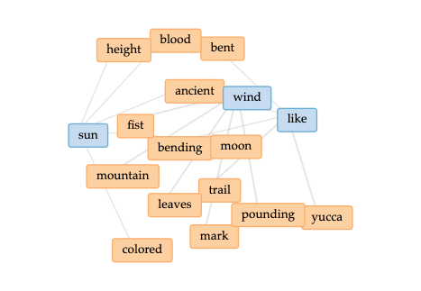
These findings helped me identify that this landscape is shaped and socially structured by narratives that are not only told about this land, but imprinted on to the landscape. The most dominant narrative is the myth of the American West which is what inspired the settlers to travel West in the first place. I am a descendent of these Mormon settlers and so I was curious to place my own work into Voyant Tools to see if there were apparent patterns between an essay I have written about this landscape, and my findings concerning the newspaper from 1878 and the Ivins City General Plan. I selected an essay that I wrote about Snow Canyon State Park, which is a state park in Ivins, Utah. I wrote the essay when I was living in Salt Lake City, Utah as an undergraduate student at the University of Utah. The essay was an assignment for an Environmental Writing class and the goal was to describe a place in nature through poetic means, in effect mythologizing it. These details are important as I was not present in Southern Utah at the time of writing the essay, instead the essay served as an attempt to produce an artifact that highlights what the state park means to me both personally and spiritually.
What was unexpected from the results is that the dominant terms used in my essay are similar to the terms found in the St. George Union (Figure 3). These digital tools helped me discover patterns that connect me, and specifically my text, to similar experiences that the early European settlers had on this same land such as remarking on the weather and incorporating the landscape into a spiritual practice. Distant reading in Voyant Tools made clear that my essay is essentially a list of similes and comparisons; "like" is the most used term in the essay. Andrew Hodgson in his book The Cambridge Guide to Reading Poetry states that figurative language "invites us to see life in altered terms; it shows us one thing in terms of another." (Pg. 164) This was clearly my attempt to turn the landscape into what I viewed and desired as my own personal idea of nature, it is my attempt to enter a type of Eden through text.
Placing my work work into Voyant Tools helped me be more analytical of my work because it provided unbiased feedback. I realized with this essay I am trying to frame this landscape within my own poetic ideal of what I believe Snow Canyon State Park means to me, turning it into something spiritual, like a clay tabernacle. By projecting my own poetic and spiritual ideal on to the landscape I am no different than the early European settlers (I am their descendent after all). It is my way of trying to own the land, without taking into context the complex cultural issues that are in conflict in this area. This act is similar to an artist painting a landscape, imbuing the artwork with their own personal desired ideal of the land—a very potent form of myth making.
This landscape is your garden


The Oxford English Dictionary defines landscape as “all the visible features of an area of countryside or land, often considered in terms of their aesthetic appeal,” and a garden as “a small piece of ground used to grow vegetables, fruit, herbs, or flowers.” All myths need landscapes and the myth of the American West was supplied with several. This myth inspired artists to create paintings of uncharted, undeveloped space that offered freedom and transcendence. Like a billboard these paintings cried out: “This landscape is your garden!” to the European immigrants who did not wish to settle in the East. These landscapes painted in the respected European styles made these depictions of the West new, but not out of a European immigrant's realm of comprehension. These landscapes were calling to the white settlers in a language they understood and what they promised was land to shape and form, a little plot of land they could own, a point on a map to drop anchor and plant a garden.
As the settlers of Southern Utah headed West, they were not alone. In the 1860s through the 1890s the U.S. Government set out to remap this landscape and replace the collective Indigenous nomenclature that had mapped the West for thousands of years with their own. They were reshaping the land in their own language and the landscape paintings from this era played a role in enforcing this new dominant discourse onto the landscape of Southern Utah. In George A. Wickliff’s Geology, Photography, and Environmental Rhetoric in the American West of 1860-1890, he states: “So began one of four nineteenth-century geological surveys of the American West, surveys in which the land was remapped, renamed, photographed, and catalogued. It was a conquest of documentation, a mission to recored all rock formations, mountain ranges, detrital plains, mines, coal deposits, soils, minerals, ores, and saline and alkaline deposits; a campaign to map the chief mining districts and the topography of the entire region; and a mission to assemble collections of botanical, geological, and ethnological specimens.”

Sven Birger Sandzen, 1928; 40 x 48 in. Oil on canvas; Springville Museum of Art

Claude Monet, 1894 40 x 25 in. Oil on canvas, National Gallery of Art (this image is in the public domain)
Sven Birger Sandzen, 1928; 40 x 48 in. Oil on canvas; Springville Museum of Art
Place your cursor over the image to see Sven Birger Sandzen's landscape of Moab that follows Monet's Impressionistic style


Figure 4, Petroglyphs located in the Santa Clara River Reserve

When looking at these landscapes and my findings from Voyant Tools it is clear that this organization of the landscape by the European settlers and U.S. government is the foundation for the dominant narratives told about this land. Each landscape painting is a single story that is part of a larger myth which helps influence how we still interpret and use the land today. The art critic Jerry Saltz writes in his essay Art is Life, “Every work of art tells a story: From hands on a cave wall to figures arrayed along a table for a Last Supper. From gleaners in a field to luncheons on the grass. From romping Greek gods to a Sunday in the park, to the cutout silhouette of a white man beating a slave.” Art is discourse that seeks to relay human experiences, desires, and hopes and dreams. It also provides for profound moments of self-reflection and these landscapes can be analyzed in context with my findings when using analytical digital tools.
Here in Southern Utah we don’t have handprints, but we do have designs and figures hammered into the crusty black dried lava bed by a deer’s antler (Figure 4). This was the Southern Paiute way of warning that this space will flood, they were signs relaying important messages derived from hundreds of years of observational knowledge handed down through the oral histories of the Indigenous peoples. These landscape paintings by European settlers on the other hand, are designed not to depict floods, but to romanticize and enhance the beauty of these spaces, the adventure of them. They influence the viewer to inhabit the landscape in a way different then the native Southern Paiutes. For example, despite this warning from the native peoples who have observed this land for hundreds of years, developers have decided to build houses in these flood zones as the consumer market seems hungry for a piece of the ideal "garden" these landscapes depict. Even the Ivins City General Plan rhetorically states with its use of language that any undeveloped space is crying out for a vacation rental. I wonder how many of these homes have paintings of the pristine empty wilderness hanging on the walls to help make the sell? What we look at does influence our actions and these landscapes help enshrine the surrounding wilderness as some pristine space that we are privileged to occupy. (Figure 5) They make the landscape seem as though it is promising something, a transcendence that can be achieved when we use this space as our own personal playground, a garden developed and organized for us to enjoy, reflect, hike, and bike.
Figure 5, Prints of landscape paintings by Jimmie Jones hanging on the wall in my living room
Wickcliff states in his essay that this was one of the desired outcomes of the U.S. Geological Surveys in the 1860s-1890s: “One of the chief products of this survey and its photographically illustrated report, The Yosemite Book (1868) was the metaphor of the valley as one of wild and unique natural wonders, a place to which Eastern tourists should come, but an attraction that could be freed of the commercialism of Niagara Falls.” By this estimation the land seems to be calling out for development, commercial tourism being a productive use of “unused” land. In Gordon Nicholas Cope’s A Desert Place Near St. George, one might see, as I do, an invitation to travel the road that draws the eye into the painting, inviting one to explore the naked and unclaimed hills that seem to roll on into a step pyramid of transcendence. It is an invitation to hike, travel, roam, inhabit and develop this glittering sandbox. My point of concern however, and what this project has taught me, is that what is missing from these landscapes is not only the people, but also the realities of the scene, the harsh elements and the violent methods that were used to empty the landscape. These landscape paintings and the continued practice of depicting Southern Utah in this way is an act of erasure that seems to be almost a revered spiritual practice. It is the intentional act of making these landscapes easy to look it; complex human problems and conditions are overlooked, instead what is depicted is an almost carnal desire of a return to the Garden of Eden where things must be easier, every moment holy, and the soul is as wild and pristine as the wilderness it occupies.

A Desert Place Near St. George, Gordon Nicholson Cope, 1936, 35 x 40 in. Oil on board, Springville Museum of Art
I cannot be too judgmental however, because I have engaged in this practice myself. I have, unintentionally, contributed to this act of erasure by simply trying to interpret the land in a way that I find respectful based on the informational panels erected by the Bureau of Land Management in Snow Canyon State Park. The many informational panels throughout the park inform the viewer that the space was once sacred to the Southern Paiutes, it was called Kiva, a temple which had the power to heal. Today, as I consistently struggle to find parking in the packed parking lot, it is clear the space has lost this sacred designation. But I do understand why this place is considered holy. What I learned by conducting a distant reading of my own essay about the park is that I also try to interpret the natural environment as something pristine and this is the narrative I choose to tell about the land. I project onto these natural formations, without asking permission, a kind of religious mysticism as though these domed clay cliffs and buttes were tablets inscribed by the very hand of God. I imprint this meaning on to them as they are a screen that welcomes my mental/spiritual projections. The painter Wulf Erich Barsch also engages in this practice. Barsch is a German immigrant to the United States, who moved to Utah in the 1960s. Below you may scroll through part of the corpus from Voyant Tools of my essay about Snow Canyon State Park. By clicking on the small plus sign (+) on the left hand side of the terms you can read passages of my essay, alongside Barsch's mystical interpretation of Snow Canyon State Park; they are both two interrelated narratives that we have imprinted onto the landscape.

In the Valley of the Sun and the Moon: Snow Canyon, Wulf Erich Barsch, 2000, 71 in x 54 in, Oil on canvas, Springville Museum of Art
Mapping today's landscape
How to use my map
As I have been exploring throughout this project I wanted to document how the narratives of the past shape contemporary views on the issues of land use, sustainability, conservation, and water usage. By clicking on each point (the red dots on the map) you are able to view a current building site in the Ivins area, alongside a quotation from one of my sources. These included the “Local" section of the St. George Union newspaper from 1878, the Ivins City General Plan, the Ivins City Newsletter, which is produced each month by the local city council, and the article Geology, Photography, and Environmental Rhetoric in the American West of 1860-1890 by Gregory A. Wickliff. By looking at current building sites in the Ivins, Utah area and texts from both historical and current resources, this map allows you to rhetorically analyze cultural views of the landscape and urban development. By right-clicking and selecting "Open Image in New Tab" you will be able to see an enlarged version of the photo. I encourage you to read the text in the description before viewing the photo to get the full intended rhetorical affect.
My Conclusions
Like a digitally generated map, Southern Utah is an area of land with many layers, many histories imprinted on top of one another. This forms complex cultural views about how one should view the land. Is it something to observe and protect? Something divine which is owed immense respect? Is it something to conquer, dominate, and control? Or is it a welcoming space where young families can come to find a plot land where they can put down roots and plant seeds? This makes Southern Utah a very American space. It is a garden continually watered by the myth of the American West where the history and legacy of colonialism continues to shape cultural views. The issue with these narratives is that, I believe, they influence negative cultural responses to the issues of over development, water scarcity, and destruction of the local ecosystem. What we want are these beautiful landscape paintings of a pristine wilderness where one can find and attain a kind of freedom and transcendence that can no longer be found in other parts of country, however, these myths and stories are in stark contrast with the reality of how the landscape is utilized today.
Karen Kidd's project looks specifically at these issues of how overdevelopment is proving problematic for the land.
It is important to note one historical comparison when discussing the area of Southern Utah. Similar to the ransacking of the Library of Alexandria by Coptic Christians, the European settlers (my ancestors) came in and destroyed an entire archive of knowledge passed down through generations about how to care for and conserve the land. This is clear in the landscape paintings that depict this area as a lush garden with unending resources. These views continue to contradict the knowledge of the Southern Paiute elders today. In a conversation with the local nonprofit Conserve Southwest Utah, Sabrina Redfoot from the Shivwit's Band of Pauites discussed the Southern Paiute's beliefs on conservation: “On our reservation and in our meetings the people are concerned about the land and the encroachment of St. George coming into our area because we pretty much leave it as it is. Some people go walking and hunting and such, but we try to preserve it and just leave it as it is and only utilize certain areas that have been approved. Now, we try to keep the reservation somewhat as wilderness so that we don't destroy what we have.”
Jimmie F. Jones, Point Sublime, 2009. Oil on canvas, 54 x 120 in. Southern Utah Museum of Art
This process of using digital tools to effectively study human culture in this area has helped me make connections to my own past and helped me learn more about my own personal experience of living here and how I can become a more active and concerned citizen. Where we live is complex, there are no easy answers, but despite these faults, I still love to watch the sunset and will travel 50 miles to see Point Sublime by Jimmie Jones on display at Southern Utah Museum of Art because within this frame it is easier to transcend looking at a landscape mapped by poetry, a pristine wilderness that holds the light and is empty of people and our pollution.